

Are you an adventure freak who is looking to conquer the misty mighty mountains of Karnataka? So, do you want to know the best trekking places in Karnataka to spend your weekend and sway away from your hectic routine life? Then you are in the right place.
Karnataka is home to more than 200 adventurous trekking destinations and holds a sweet spot amongst the trekking enthusiasts.
Here is a list of some great trekking trails in Karnataka that you shouldn’t even think of missing.
Table of Contents
Best Trekking Places In Karnataka
Kumara Parvatha Trek
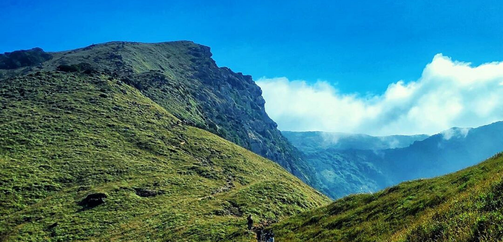
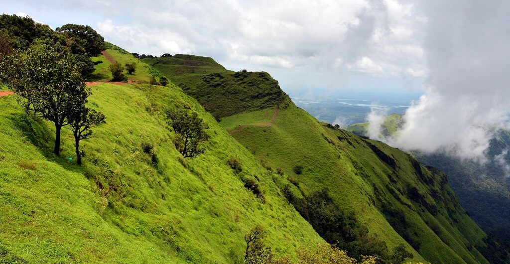
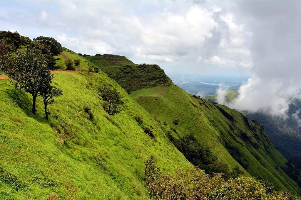
Kumara Parvatha is the beast as some people call it and it is considered as one of the toughest treks in Karnataka. If you are an adventure seeker then you are going to fall in love with this beast. This mountain is located behind Kukke Subramanya Temple in the Western Ghats region and is also popularly known as Pushpagiri.
Trekking trail leads you through misty dense forests, tall grasslands, large volcanic rocks, beautiful looking streams, the valley that reflects different shades of green, and a wide range of fauna. Even though this trek makes you sweat profusely, what unparalleled beauty awaits you at the top of the mountain is worth the climb.
Usually, it is a 2-day trek, where you can reach Bhattara Mane which is a halfway mark and stay overnight pitching your own tents and reach the peak the next day by seeking the forest officer’s permission. A man called Bhat runs the show in Bhattara Mane by providing trekkers with simple food, shelter, and does all arrangements for camping with a bonfire at minimum cost. Additionally, there are washrooms near this place and that certainly raises the comfort level of trekkers.
Note: You are not allowed to camp beyond Bhattara Mane’s region.
There is another route to reach the Kumara Parvatha summit i.e. through Somwarpet (Coorg) side. It is a long as well as difficult trek compared to the other side and there are no signboards or proper pathways, hence it is advisable to hire an experienced trek guide.
Bhattara Mane’s Phone Number For Enquiry: +919448647941 , +919480230191 , +919945618495, & +9194486 47947
Kumara Parvatha Trek Information
- Kumara Parvatha Trek Distance – 26 km (to & fro)
- Altitude – 1712 m (5,617 ft) above sea level
- Trek Time – 10 to 12 hours
- Kumara Parvatha Entry Fee – Rs. 300 / person.
- Difficulty Level – Moderate to Difficult
- Best Time To Trek – Oct To Feb
- Location- Pushpa Giri Wildlife Sanctuary near Kukke Subramanya Temple
- Camping – Yes, camping can be done near Bhattara mane by seeking forest officer’s permission.
- Camping Fee: Rs. 200.
- Distance from Bangalore – 281 Km
Thadiyandamol Trek
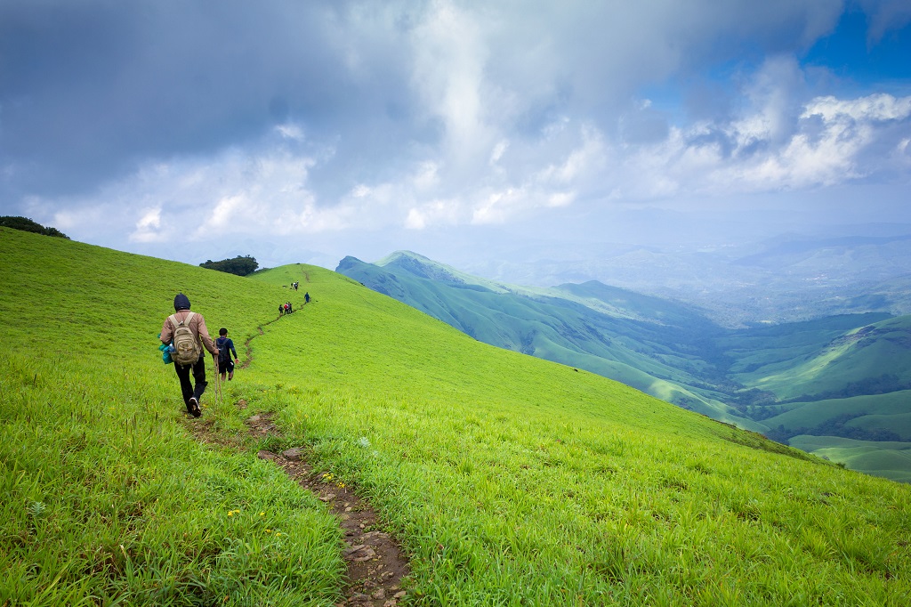
The highest peak in Coorg and also the best trekking spot in western ghats for beginners to start their trekking journey. No complications at all as the trail is clearly marked, the chance of you getting lost is nil. Thadiyandamol trek base starts from a small village called Kakkabe. As you start trekking into the wild, the view of Shola forests, greeny grasslands, water streams running in different directions, vegetations everywhere, colorful birds flying over you is a delight to your eyes. Apart from this what scenic beauty awaits you at the top of the peak is pure bliss.
Once you have trekked for about 2 km from the base, there is a big rock where people prefer camping, as it is quite windy at the peak. In fact, you can pitch your tents here, have packed foods, lit the bonfire to protect yourself from chilled nights and sign off for the day under the twinkling stars But be very careful when you are camping here, as chances of elephants paying a visit at night are possible.
In addition, there is a Nalknad Palace in the village Yavakapadi, located just 2 km prior to the trek base. Nalknad Palace is a 200-year-old architecture built by Kodava rulers to seek refuge during the wartime. A lot of travelers who wants to spend more time with nature, park their vehicle near the palace and start trekking towards Tadiandamol peak from this point. The journey from the palace to Base camp is a beautiful one, as you will be walking amidst aromatic coffee plantations, colorful flowers, fruits, and huge trees.
Thadiyandamol Trek Information
- Thadiyandamol Trek Distance – 14 km (to & fro)
- Altitude – 1748 m (5735 ft) above sea level
- Trek Time – 6 hours
- Thadiyandamol Entry Fee – Rs. 20 / person.
- Difficulty Level – Easy to Moderate
- Best Time To Trek – Oct To Feb
- Location – Kakkabe 25 km from Virajpet, Coorg
- Camping – Yes, Camping can be done near the big rock that is 2 km from the forest entry point.or near Nalknad Palace.
- Camping Fee: Nil.
- Distance From Bangalore – 268 Km
Kudremukh Trek
Popularly known for the distinctive shape of the peak, which resembles the horse face. In fact, “ Kudremukh” in native Kannada language means “Horse face”.
Trek begins from Mullodi village, which is 5 km away from Balegal. To reach Mullodi either you need to take a jeep ride from Balegal or if you feel like exploring more you can take a walk. Now that you reach base, you will be allotted with a guide, who will be part of your adventurous journey till you reach base again. It is a long and hectic trek, hence it is advisable to start as early as possible to gain an advantage.
As you start your trekking trail, Kudremukh brings something new every single time be it Streams, bamboo shrubs, tiny waterfalls, lush vegetation, meadows, coffee plantations or rain forests that look fresh mostly. Trekking here is similar to watching a movie, as you keep moving forward, sceneries in nature keep on changing. Sometimes you will be walking in the streams; the next movement you will be walking through clouds; and the next movement elsewhere. And this is what makes this place all the more amazing.
Once you reach the top, the view of the valley beneath you, as if the green carpet has been laid out on the whole mountain is mind-blowing.
If you are lucky you can spot bison, spot deer, sambar, and peacock while trekking.
Note:- In Kudremukh trek, they allow only 50 people/day.
Kudremukh Trek Information
- Kudremukh Trek Distance – 22 km (to & fro)
- Altitude – 1894 m (6207 ft) above sea level
- Trek Time – 8 to 10 hours
- Kudremukh Entry Fee – Rs. 475 / person.
- Difficulty Level – Moderate
- Best Time To Trek – Oct To March.
- Location- Kudremukh Reserve Forest, Chikmagalur.
- Camping – No, they don’t allow you to camp as this destination is in Reserve Forest.
- Distance from Bangalore – 330 Km
Kodachadri Trek
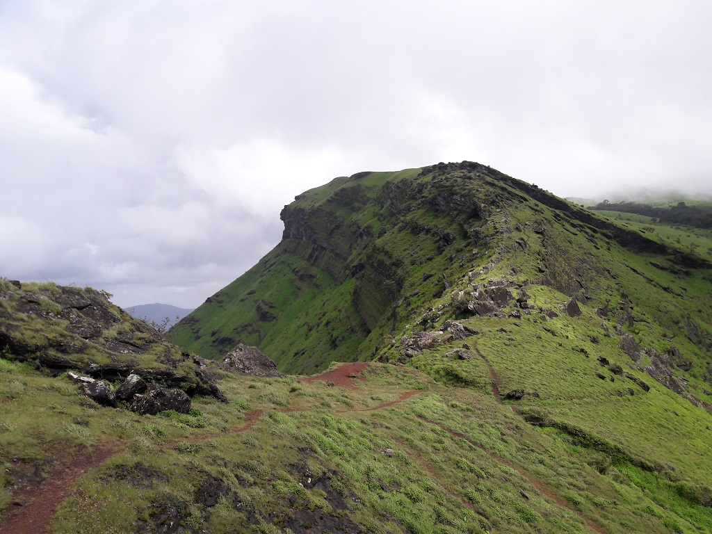
One of the most beautiful and most celebrated trekking destinations in Karnataka. Standing tall at 1300 m, Kodachadri is the 10th highest peak in Karnataka. Sampekatte in Nittur Village is the trek base, it is at 20 km from Kollur. There are a lot of Jeeps available from Kollur which will drop you near the trek base. And there are jeeps that will carry you till the halfway mark of Kodachadri trek (i.e. near the temple) if you don’t like trekking or you want to take a bumpy adventurous off-road trail, then go for it.No need of any guide if you wish to trek as there is a proper pathway.
Kodachadri Trek Route 1
As you start your trek near Sampekatte and enter forest area, Kodachadri starts to unveil a lot of surprises to you and if you are a nature lover then for sure you will fall for it. Firstly, you will come across popular Hidlumane falls, then multiple tiny streams, grassy meadows, and a wide variety of flora and fauna.
There is a temple and Kodachadri Information Bureau near halfway mark. Moreover, this is the place where you are allowed to camp pitching your tents and jeeps don’t go beyond this point. Kodachadri Information Bureau also provides simple food like rice, sambar, buttermilk, and pickle on request, at a minimum cost.
In fact, the real fun and surprises start only after reaching the summit. There is a Shankara Peetha, a place where Adi Shankaracharya is believed to have meditated.Sunsets here are really mesmerizing and it has a great history, as this sunset has been showcased in many Indian films.
Kodachadri Trek Route 2
Alternatively, there is another easy route to reach the Kodachadri peak. It is a short trek of 5 km. Trek base starts from Karekatte village and you need to pass through Santosh hotel in Valuru. After this, you need to move across a forest and tall grasslands trail to reach the summit.
No, the adventure hasn’t ended yet, there is a place like Ganapathi cave and Chitramoola caves which are 2km further away from the peak, but you need to take an experienced guide, as the path gets really confusing after the summit.
Note- Guides are available but you need to show your bargaining skills. Usually, guides charge around Rs. 500 to 1000 and in some cases, jeep drivers itself act as guides.
Mookambika wildlife sanctuary is known for its wide variety of wildlife like Malabar giant squirrel, Malabar langur, emerald pigeons, Bison, Tiger, King Cobra and pythons
Kodachadri Trek Information
- Kodachadri Trek Distance – 16 km
- Altitude – 1300 m (4406 ft) above sea level
- Trek Time – 8 hours
- Entry Fee – Nil.
- Difficulty Level – Moderate
- Best Time To Trek – Oct To March
- Location- Mookambika wildlife sanctuary, 20 km from Kollur, Shimoga.
- Camping – Yes, you can plan to pitch a tent at halfway mark near Kodachadri Information Bureau or stay at a priest house.
- Camping Fee – Nil.
- Distance from Bangalore – 422 Km
Mullayanagiri Trek
Mullayanagiri, renowned as Karnataka’s highest peak, is located in Baba Budan range of western ghats. The mountain got its name as Tapasvi Mullapa Swamy had mediated in one of the caves just below the peak.
You can reach the summit either through trekking or you can take your vehicle to the top from where the peak is 500 steps away.
If you happen to choose trekking then you need to take the Sarpadhari route. After getting down in Chikmagalur, you can ask any Auto rickshaw guy to drop you near the trekking base and he might charge you around Rs. 150 to 200.
You can start marching towards the peaks, on a small muddy path in between dense forest. The path you take has a narrow stream, waterfalls and at times the trail gets harder as you need to make a 60-degree steep climb to proceed further.
As you get closer to peak the breeze gets colder and the visibility becomes almost blurry as it is covered with dense mist. There is a shiva temple, Nandi statue and two old colorful caves formed by the mixture of several minerals near the peak. The panoramic view of Chikmagalur city; aromatic coffee plantation; green patches of grasslands; small streams, lugged rocks; Baba Budan Giri peak and mist everywhere makes this look like a tiny paradise.
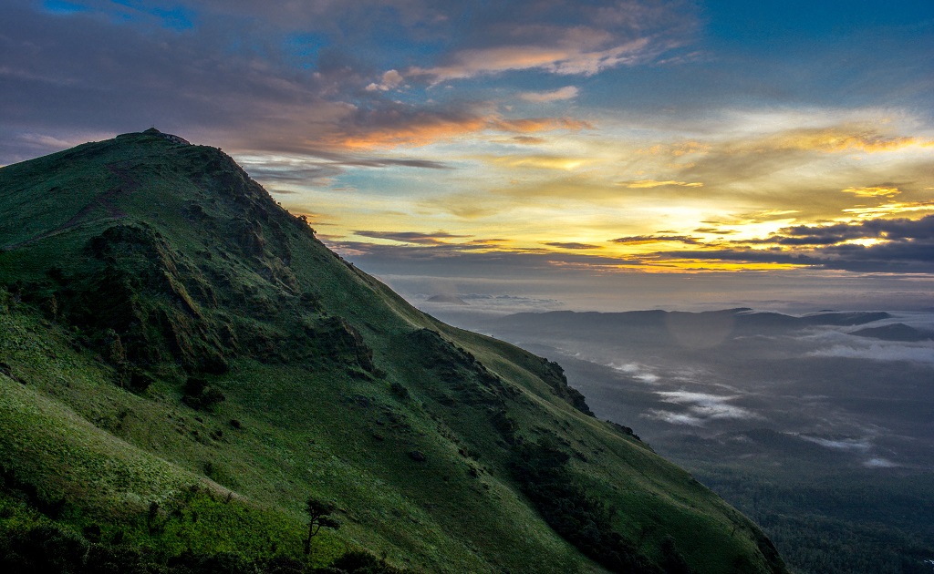
Above all, as the sun rises through the sea of clouds, it sure looks magical beyond explanation.
Mullayanagiri Trek Information
- Mullayanagiri Trek Distance – 7 km (to & fro).
- Altitude – 1930 m (6330 ft) above sea level.
- Trek Time – 4 hours
- Entry Fee – NA.
- Difficulty Level – Easy.
- Best Time To Trek – Sep To April
- Location- Baba Budan Giri Range, 15 Km from Chikmagalur.
- Camping – Yes, you can pitch a tent finding a suitable place as there are no restrictions.
- Camping Fee – NA.
- Distance from Bangalore – 260 Km
Nishani Motte Trek
If you don’t want any crowd to follow you even on weekends then this Offbeat trekking destination near Talacauvery wildlife sanctuary, in Coorg should be on your list. You need to seek permission from the Bhagamandala forest office before you start your trek from Madenadu village base camp, which is 7 km away. You need to hire a jeep to reach the base camp.
Additionally, it is advisable to hire an experienced guide, as the paths in this region are not marked properly and there is a chance of you getting lost in the forest.
Initial stages of the trek are relatively easy compared to the final leg which is very steep. Nishani Motte trekking trail will lead you through Coffee estates, cardamom plantations, paddy fields, thick rainforests, small freshwater streams, and dashing meadows.
Even though the final phase of the trek is a little harder as you need to walk on narrow ridges, the climb to the top is absolutely worth it. The scintillating view of the misty mountain ranges and the green-topped valley will sweep any nature lover off the ground.
Sometimes you can spot bison, snakes, elephants, wild bears and leopards at far distances, while you are trekking.
Nishani Motte Trek Information
- Nishani Motte Trek Distance – 15 Km (to & fro)
- Altitude – 1270 m (4167 ft) above sea level.
- Trek Time – 6 to 7 hours
- Entry Fee – Rs.200 / person.
- Difficulty Level – Moderate.
- Best Time To Trek – Sep To March
- Location-Talacauvery wildlife sanctuary, Coorg.
- Camping – No, they don’t allow you to camp.
- Distance from Bangalore – 284 Km
Z point Kemmanagundi Trek
At 60 km from Chikmagalur, this lesser-known destination is a hotspot among travelers and adventure enthusiasts. The trail to the peak is zig-zag and resembles the English alphabet “Z”, hence it is called a Z point.
It is a short trek that begins from Kemmanagundi Raj Bhavan, located inside a dense forest of western ghats. There is a checkpoint here and you will not be allowed to carry any kind of alcohol or drugs.
The first phase of the trek until Shanti waterfalls is easy. The second phase i.e. trek towards the peak.is a little harder, as the path becomes more slippery; steep and sometimes you need to walk on narrow ridges that have steep valley on one side and big mountains leaning on you on the other side. And what makes it scarier is, there are no fences or railings that support you and one slip can land you right on the bottom of the mountain.
The summit will receive you with the cool breeze no matter what time of the day it is and sometimes strong winds can blow you off the ground. There are many factors like the bird’s eye view of the city; a steep valley with a variety of trees; at certain points walking above the clouds and the view of the sun going down the horizon will make any traveler go crazy.
Z point Trek Information
- Z point Trek Distance – 6 Km (to & fro)
- Altitude – 1500 m (4,921 ft) above sea level
- Trek Time – 4 hours
- Z Point Entry Fee – Rs. 100/person.
- Difficulty Level – Moderate,
- Best Time To Trek – Oct To March
- Location- Kemmanagundi, 60 Km from Chikmagalur.
- Camping – Yes, camping at z point is possible.
- Distance from Bangalore – 274 Km
Conclusion
Bored with your routine weekend stuff, then try hitting any of these beautiful trekking spots in Karnataka with your friends who are crazy about adventures
Have you ever been to these trekking places in Karnataka? Which one did you like the most?
Please share it in the comment section below, we are happy to hear from you.
Also, read: Best One-Day Treks Near Bangalore
Comments